
Click on a plate to view a larger image
 |
National Park Service
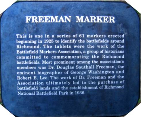
Plate This is one in a series of 61 markers erected beginning in 1925 to identify the battlefields around Richmond. The tablets were the work of the Battlefield Markers Association, a group of historians committed to commemorating the Richmond battlefields. Most prominent among the association's members was Dr. Douglas Southall Freeman, the eminent biographer of George Washington and Robert E. Lee. The work of Dr. Freeman and the Association ultimately led to the purchase of battlefield lands and the establishment of Richmond National Battlefield Park in 1936. |
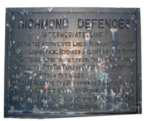 |
#1 Richmond Defences Intermediate
Line Here ran the intermediate line of Richmond defences. Built in 1862-64, these defences included 25 inner forts and batteries, beyond which this continuous earthwork encircled the city. The third or outer line was distant from the capitol 4 to 7 miles. Out this road the two divisions of D.H. Hill and of James Longstreet followed Gen. R.E. Lee on June 26, 1862, for the opening battle of the Seven Days' Campaign. [Marker not numbered] |
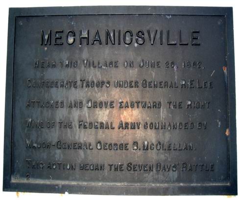 |
#2 Mechanicsville Near this village on June 26, 1862, Confederate troops under General R.E. Lee attacked and drove eastward the right wing of the Federal army commanded by Major-General George B. McClellan. This action began the Seven Days' Battle. |
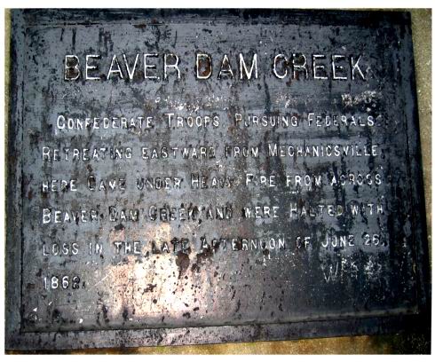 |
#3 Beaver Dam Creek Confederate troops pursuing Federals retreating eastward from Mechanicsville here came under heavy fire from across Beaver Dam Creek and were halted with loss in the late afternoon of June 26, 1862. |
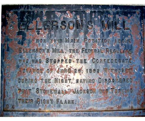 |
#4 Ellerson's Mill From this main position above Ellerson's Mill, the Federal regulars who had stopped the Confederate advance of June 26, 1862 withdrew during the night, having discovered that "Stonewall" Jackson was turning their right flank. |
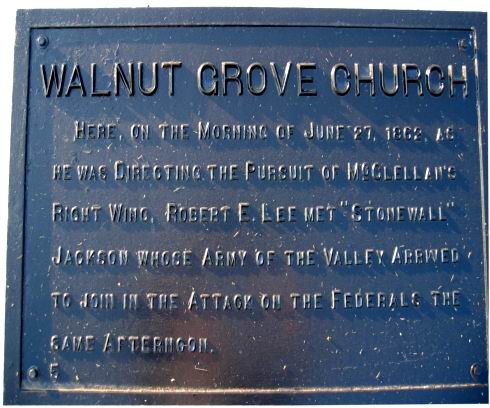 |
#5 Walnut Grove Church Here, on the morning of June 27, 1862, as he was directing the pursuit of McClellan's right wing, Robert E. Lee met "Stonewall" Jackson whose Army of the Valley arrived to join in the attack on the Federals the same afternoon. |
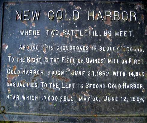 |
#6 New Cold Harbor Where Two
Battlefields
Meet Around this crossroads is bloody ground. To the right is the field of Gaines' Mill or First Cold Harbor, fought June 27, 1862, with 14,800 casualties. To the left is Second Cold Harbor, near which 17,00 fell, May 30 - June 12, 1864. |
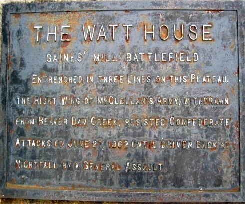 |
#7 The Watt House Gaines' Mill
Battlefield Entrenched in three lines on this plateau, the right wing of McClellan's army, withdrawn from Beaver Dam Creek, resisted Confederate attacks on June 27, 1862 until driven back at nightfall by a general assault. |
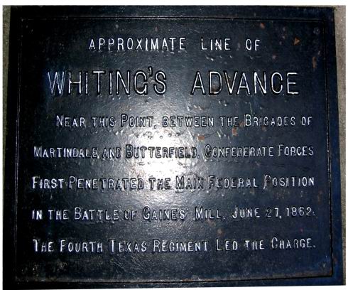 |
#8 Approximate Line of
Whiting's
Advance Near this point, between the brigades of Martindale and Butterfield, Confederate forces first penetrated the main Federal position in the Battle of Gaines' Mill, June 27, 1862. The Fourth Texas Regiment led the charge. |
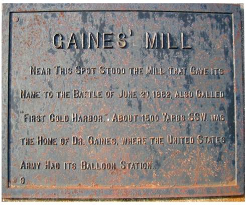 |
#9 Gaines' Mill Near this spot stood the mill that gave its name to the battle of June 27, 1862 also called First Cold Harbor. About 1500 yards SSW was the home of Dr. Gaines, where the United States Army had its balloon station. |
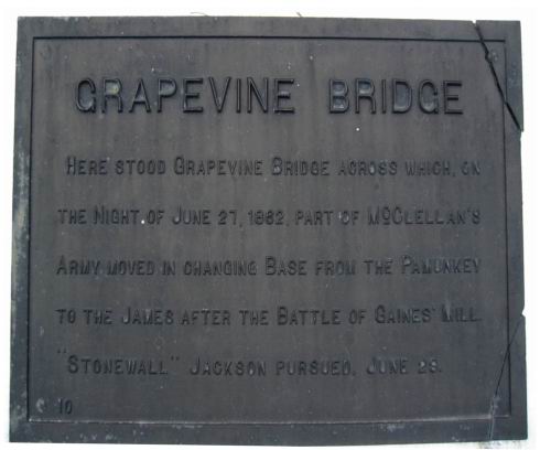 |
#10 Grapevine Bridge Here stood Grapevine Bridge across which, on the night of June 27, 1862, part of McClellan's Army moved in changing base from the Pamunkey to the James after the Battle of Gaines' Mill. "Stonewall" Jackson pursued, June 29. |
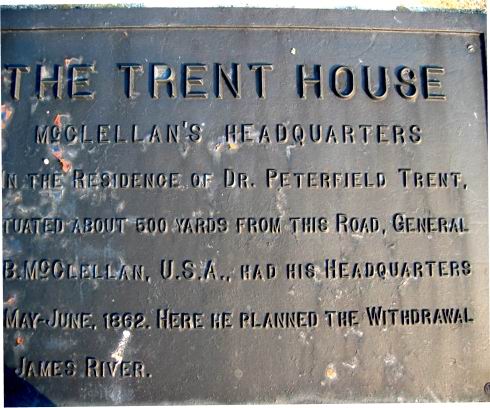 |
#11 The Trent House McClellan's
Headquarters In the residence of Dr. Peterfield Trent, situated about 500 yards from this road, General G.B. McClellan, U.S.A., had his headquarters in May-June, 1862. Here he planned the withdrawal to James River. |
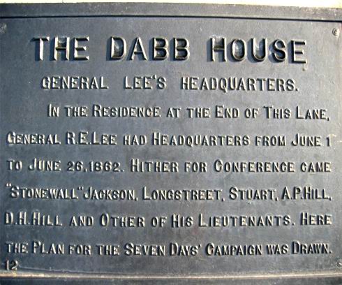 |
#12 The Dabb House General Lee's
Headquarters In the residence at the end of this lane, General R.E. Lee had headquarters from June 1 to June 26, 1862. Hither for conference came Stonewall Jackson, Longstreet, Stuart, A.P. Hill, D.H. Hill and other of his lieutenants. Here the plan for the Seven Days Campaign was drawn. |
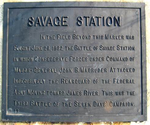 |
#13 Savage Station In the field beyond this marker was fought June 29, 1862, the battle of Savage Station in which Confederate forces under command of Major-General John B. Magruder attacked indecisively the rearguard of the Federal Army moving toward James River. This was the Third Battle of the Seven Days Campaign. [Moved from Old Williamsburg Road South of here] |
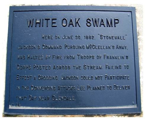 |
#14 White Oak Swamp Here on June 30, 1862, Stonewall Jackson's command, pursuing McCellan's Army, was halted by fire from troops of Franklin's Corps posted across the stream. Failing to effect a crossing, Jackson could not participate in the converging attacks Lee planned to deliver that day near Glendale. |
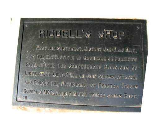 |
#15 Riddell's Shop West and Southwest, distant one-half mile lies the Battlefield of Glendale or Frazier's Farm, where the Confederate divisions of Longstreet and A.P. Hill on June 30, 1862, attacked and forced the withdrawal of Federal troops covering McClellan's march toward James River. |
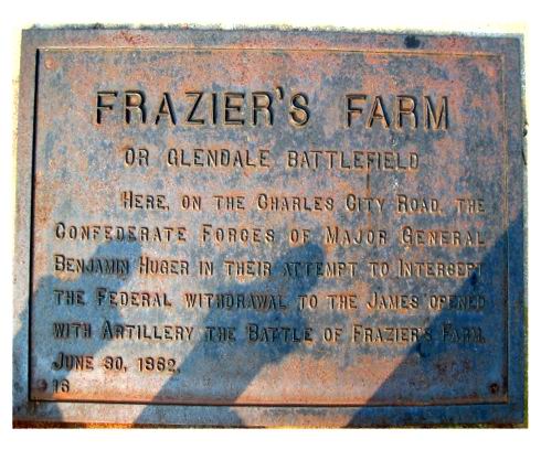 |
#16 Frazier's Farm or Glendale
Battlefield Here, on the Charles City Road, the Confederate forces of Major General Benjamin Huger in their attempt to intercept the Federal withdrawal to the James opened with artillery the Battle of Frazier's Farm, June 30, 1862. |
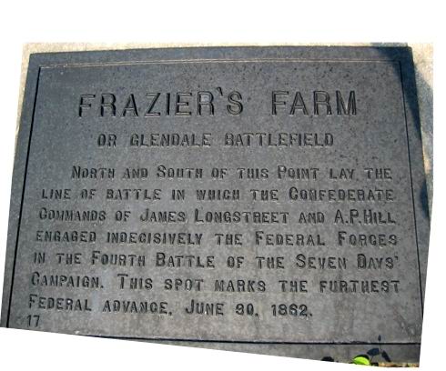 |
#17 Frazier's Farm or Glendale
Battlefield North and South of this point lay the line of battle in which the Confederate commands of James Longstreet and A.P. Hill engaged indecisively the Federal forces in the Fourth Battle of the Seven Days Campaign. This spot marks the furthest Federal advance, June 30, 1862. |
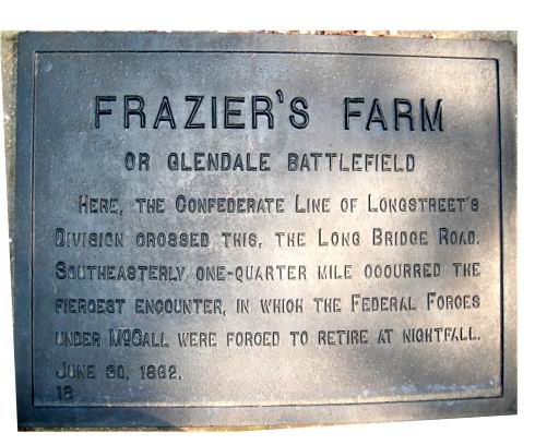 |
#18 Frazier's Farm or Glendale
Battlefield Here, the Confederate line of Longstreet's Division crossed this, the Long Bridge Road. Southeasterly one-quarter mile occurred the fiercest encounter, in which the Federal forces under McCall were forced to retire at nightfall June 30, 1862. |
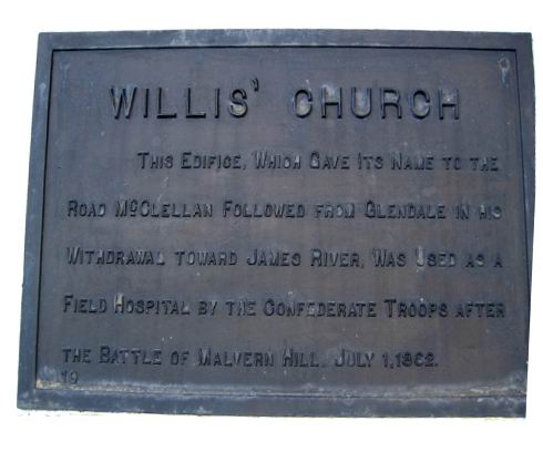 |
#19 Willis' Church This edifice, which gave its name to the road McClellan followed from Glendale in his withdrawal toward James River, was used as a field hospital by the Confederate troops after the Battle of Malvern Hill. July 1, 1862. |
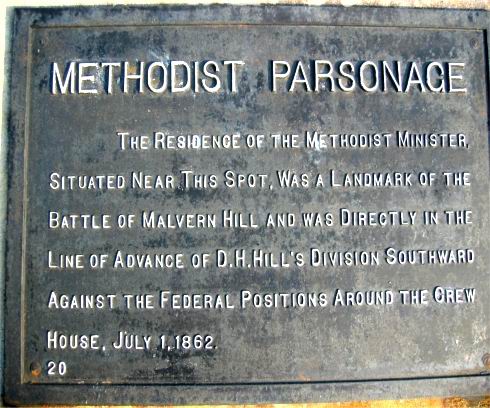 |
#20 Methodist Parsonage The residence of the Methodist minister, situated near this spot, was a landmark of the Battle of Malvern Hill and was directly in the line of advance of D.H. Hill's division southward against the Federal positions around the Crew house. July 1, 1862. |
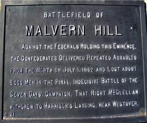 |
#21 Battlefield of Malvern Hill Against the Federals holding this eminence, the Confederates delivered repeated assaults from the North on July 1, 1862 and lost about 5,000 men in the final, indecisive Battle of the Seven Days Campaign. That night McClellan withdrew to Harrison's Landing, near Westover. |
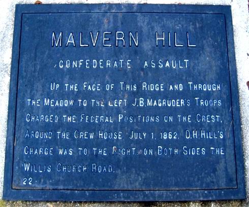 |
#22 Malvern Hill Confederate
Assault Up the face of this ridge and through the meadow to the left J.B. Magruder's troops charged the Federal positions on the crest, around the Crew House, July 1, 1862. D.H. Hill's charge was to the right, on both sides of the Willis Church Road. |
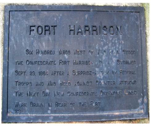 |
#23 Fort Harrison Six hundred yards West of this road stood the Confederate Fort Harrison. It was stormed Sept. 29, 1864 after a surprise-attack by Federal troops and was held against counter attacks the next day. New Confederate defensive lines were drawn in rear of the fort. |
| None | #24 not in use There is no marker numbered 24 |
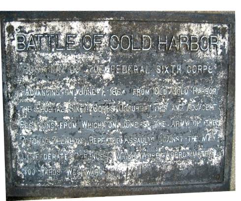 |
#25 Battle of Cold Harbor Position
of the Federal Sixth Corps Advancing on June 1, 1864 from Old Cold Harbor, the Federal Sixth Corps occupied this and adjacent positions from which on June 3 the Army of the Potomac delivered repeated assaults against the main Confederate defences, which were approximately 400 yards westward. |
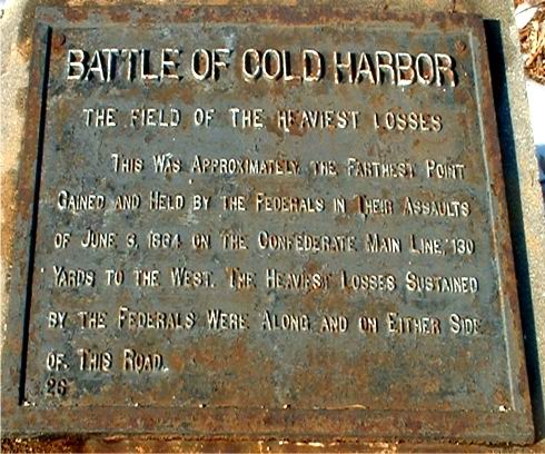 |
#26 Battle of Cold Harbor The
Field
of the Heaviest Losses This was approximately the farthest point gained and held by the Federals in their assaults of June 3, 1864 on the Confederate main line, 130 yards to the west. The heaviest losses sustained by the Federals were along and on either side of this road. |
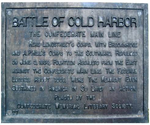 |
#27 Battle of Cold Harbor The
Confederate
Main Line Here Longstreets Corps, with Breckinridge and A.P. Hills Corps to the southward, repulsed on June 3, 1864, fourteen assaults from the East against the confederate main line. The federal losses, about 7000, were the heaviest ever sustained in America in so brief an action. Placed by the Confederate Memorial Literary Society. |
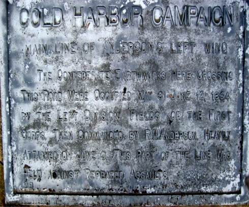 |
#28 Battle of Cold Harbor Main
Line
of Andersons Left Wing The Confederate earthworks here crossing this road were occupied May 31 June 12, 1864, by the Left Division Fields of the First Corps. Then commanded by R.H. Anderson. Heavily attacked on June 3, this part of the line was held against repeated assaults. |
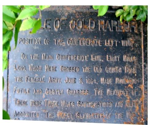 |
#29 Battle of Cold Harbor Position
of the Confederate Left Wing On the main Confederate line, eight miles long, which here crossed the Old Church Road, the Federal Army, June 3, 1864, made numerous futile and costly charges. The heaviest of these were three miles southeastward and were accounted the worst slaughter of the war. |
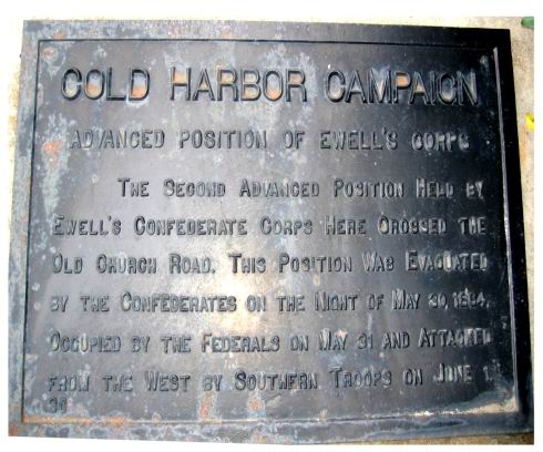 |
#30 Cold Harbor Campaign Advanced
Position of Ewell's Corps The second advanced position held by Ewells Confederate Corps here crossed the Old Church Road. This position was evacuated by the Confederates on the night of May 30, 1864. Occupied by the Federals on May 31 and attacked from the West by Southern troops on June 1. |
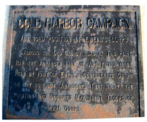 |
#31 Cold Harbor Campaign Advanced
Position of Ewell's Corps Across the Old Church road at this point ran the advanced line of about 700 yards held by part of Ewells Confederate Corps on May 30, 1864. Abandoned that night, the position was occupied May 31 by troops of the Fifth Federal corps. |
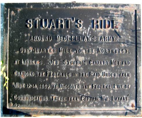 |
#32 Stuarts Ride Around
McClellans
Army One-quarter mile to the Northwest, at Linneys, Jeb Stuarts cavalry met and charged the Federals in the raid undertaken June 12-14, 1862, to discover the Federal line of communication. There fell Captain Wm. Latane. |
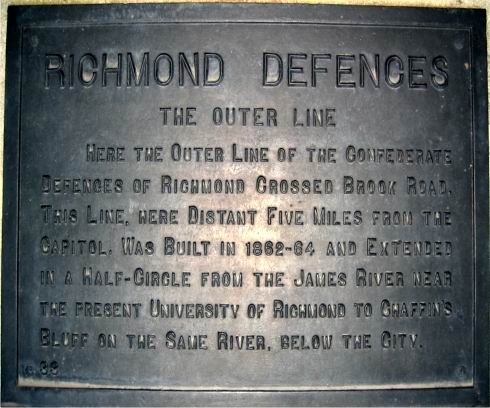 |
#33 Richmond Defences The Outer
Line Here the outer line of the Confederate defences of Richmond crossed Brook Road. This line, here distant five miles from the capitol, was built in 1862-64 and extended in a half-circle from the James River near the present University of Richmond to Chaffins Bluff on the same river, below the city. |
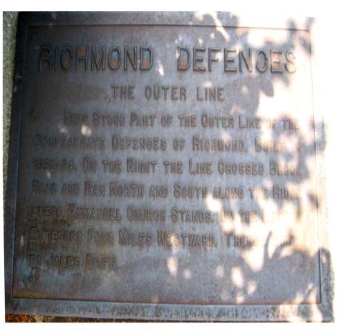 |
#34 Richmond Defences The Outer
Line Here stood part of the outer line of the Confederate defences of Richmond, built in 1862-64. On the right the line crossed Brook Road and ran North and South along the ridge where Emmanuel church stands. On the left it extended four miles Westward, thence South to James River. |
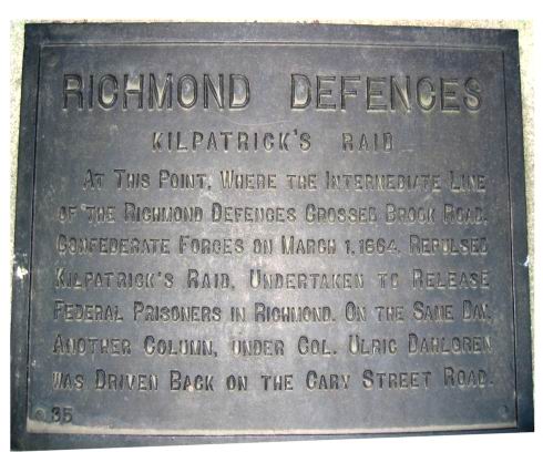 |
#35 Richmond Defences Kilpatricks
Raid At this point, where the intermediate line of the Richmond defences crossed Brook Road, Confederate forces on March 1, 1864, repulsed Kilpatricks Raid, undertaken to release Federal prisoners in Richmond. On the same day, another column, under Col. Ulric Dahlgren was driven back on the Cary Street Road. |
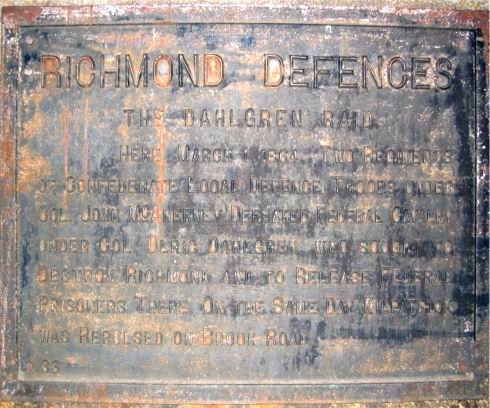 |
#36 Richmond Defences The Dahlgren
Raid Here March 1, 1864, two regiments of Confederate local defence troops under Col. John McAnerney defeated Federal cavalry under Col. Ulric Dahlgren, who sought to destroy Richmond and to release Federal prisoners there. On the same day Kilpatrick was repulsed on Brook Road. |
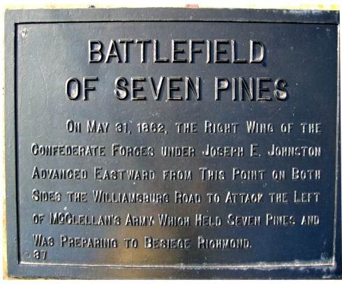 |
#37 Battlefield of Seven Pines On May 31, 1862, the Right Wing of the Confederate Forces under Joseph E. Johnston advanced Eastward from this point on both sides the Williamsburg Road to attack the left of McClellan's Army which held Seven Pines and was preparing to besiege Richmond. |
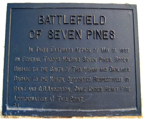 |
#38 Battlefield of Seven Pines In their Eastward attack of May 31, 1862 on Federal troops holding Seven Pines, Rodes' Brigade to the South of this highway and Garlands Brigade to the North, supported respectively by Rains and G.B. Anderson, came under heavy fire approximately at this point. |
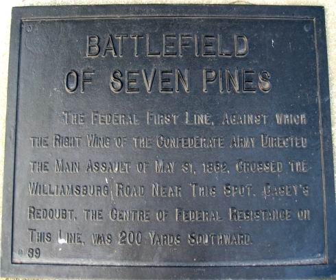 |
#39 Battlefield of Seven Pines The Federal First Line, against which the Right Wing of the Confederate Army directed the main assault of May 31, 1862, crossed the Williamsburg Road near this spot. Casey's Redoubt, the centre of Federal Resistance on this line, was 200 yards Southward. |
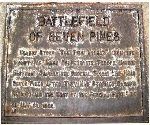 |
#40 Battlefield of Seven Pines Nearby stood "The Twin Houses" from the vicinity of which Confederate Troops moving eastward, charged the Federal Second Line near Seven Pines after they had stormed Casey's Redoubt and the rest of the Federal First Line on May 31, 1862. |
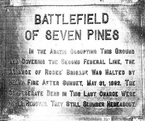 |
#41 Battlefield of Seven Pines In the abatis occupying this ground and covering the second Federal line, the advance of Rodes' Brigade was halted by heavy fire after sunset, May 31,1862. The Confederate dead in this last charge were never removed. They still slumber hereabout. [Courtesy of Michael Tyler] |
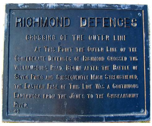 |
#42 Richmond Defences Crossing of
the Outer Line At this point the outer line of the Confederate Defences of Richmond crossed the Williamsburg Road. Begun after the Battle of Seven Pines and subsequently much strengthened, the Eastern face of this line was a continuous earthwork from the James to the Chickahominy River. |
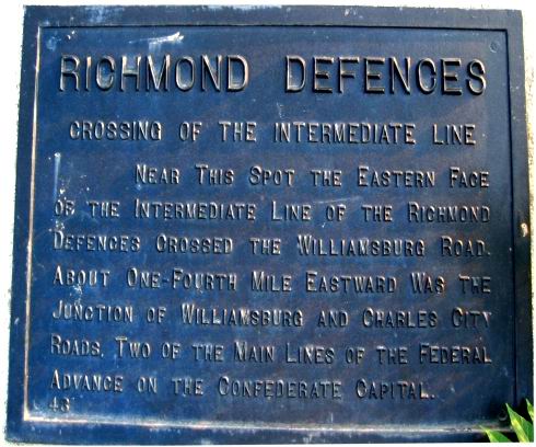 |
#43 Richmond Defences Crossing of
the Intermediate Line Near this spot the Eastern face of the Intermediate Line of the Richmond Defences crossed the Williamsburg Road. About one-fourth mile Eastward was the Junction of Williamsburg and Charles City Roads, two of the main lines of the Federal advance on the Confederate capital. |
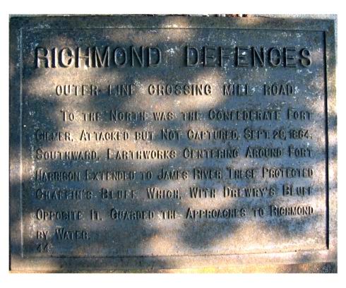 |
#44 Richmond Defences Outer-Line
Crossing Mill Road To the North was the Confederate Fort Gilmer, attacked but not captured, Sept. 29,1864. Southward, earthworks centering around Fort Harrison extended to James River. These protected Chaffin's Bluff which, with Drewry's Bluff opposite it, guarded the approaches to Richmond by water. |
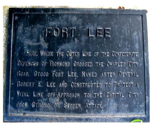 |
#45 Fort Lee Here, where the outer line of the Confederate defences of Richmond crossed the Charles City Road, stood Fort Lee, named after General Robert E. Lee and constructed to protect a vital line of approach to the capital city from strong or sudden attack. |
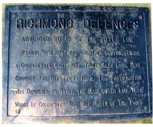 |
#46 Richmond Defences Advanced
Works
of the Outer Line Running Southeastward and then Southwestward. A Confederate earthwork, three miles long, here crossed the Darbytown Road. This fortification was designed to cover the Main Outer Line, with which it connected, one mile North of this point. |
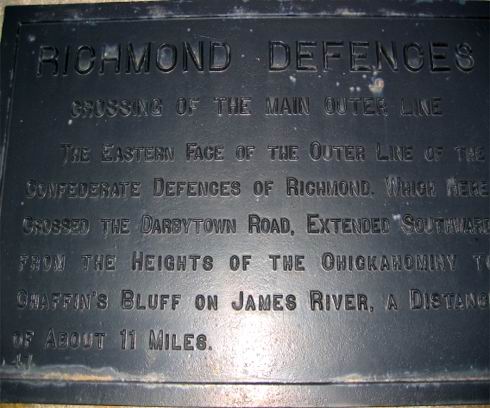 |
#47 Richmond Defences Crossing of
the Main Outer Line The eastern face of the Outer Line of the Confederate defences of Richmond, which here crossed the Darbytown Road, extended Southward from the heights of the Chickahominy to Chaffin's Bluff on James River, a distance of about 11 miles. |
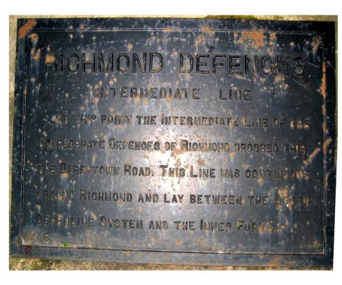 |
#48 Richmond Defences Intermediate
Line At this point the Intermediate Line of the Confederate defences of Richmond crossed this, the Darbytown Road. This line was continuous around Richmond and lay between the outer defensive system and the inner forts. |
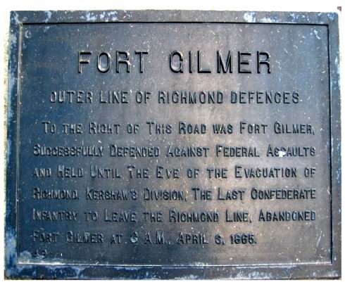 |
#49 Fort Gilmer Outer Line of
Richmond
Defences To the right of this road was Fort Gilmer, successfully defended against Federal assaults and held until the eve of the evacuation of Richmond. Kershaw's Division, the last Confederate infantry to leave the Richmond line, abandoned Fort Gilmer at 3 A.M., April 3, 1865. |
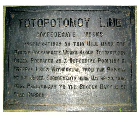 |
#50 Totopotomoy Line Confederate
Works Fortifications on this hill mark the strong confederate works along Totopotomoy Creek, prepared as a defensive position in General Lees withdrawal from the Rapidan to the James. Engagements here May 29-30, 1864, were preliminary to the Second Battle of Cold Harbor. |
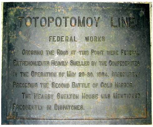 |
#51 Totopotomoy Line Federal
Works Crossing the road at this point were Federal entrenchments heavily shelled by the Confederates in the operation of May 29-30, 1864, immediately preceding the Second Battle of Cold Harbor. The nearby Shelton House was mentioned frequently in dispatches. |
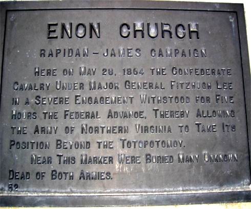 |
#52 Enon Church Rapidan-James
Campaign Here on May 28, 1864 the Confederate cavalry under Major General Fitzhugh Lee in a severe engagement withstood for five hours the Federal advance, thereby allowing the Army of Northern Virginia to take its position beyond the Totopotomoy. Near this marker were buried many unknown dead of both armies. |
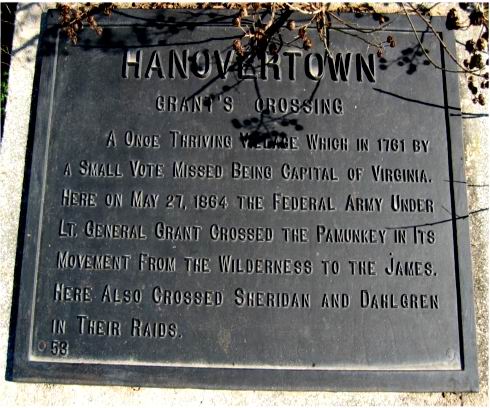 |
#53 Hanovertown Grant's
Crossing A once thriving village which in 1761 by a small vote missed being capital of Virginia. Here on May 27, 1864 the Federal army under Lt. General Grant crossed the Pamunkey in its movement from the Wilderness to the James. Here also crossed Sheridan and Dahlgren in their raids. |
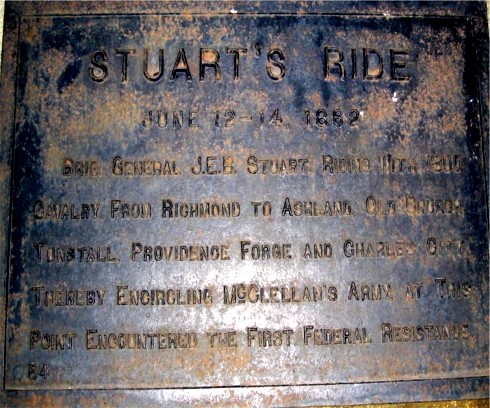 |
#54 Stuart's Ride June 13-14,
1862 Brig. General J.E.B. Stuart, riding with 1800 cavalry from Richmond to Ashland, Old Church, Tunstall, Providence Forge, and Charles City, thereby encircling McClellan's Army, at this point encountered the first Federal resistance. [Courtesy of Michael Tyler] |
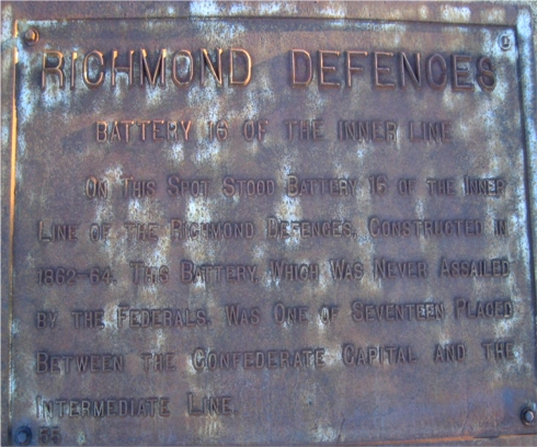 |
#55 Inner Defences Battery 16 of
the Inner Line On this spot stood Battery 16 of the Inner Line of the Richmond Defences, constructed in 1862-64. This Battery, which was never assailed by the Federals, was one seventeen placed between the Confederate capital and the Intermediate Line. |
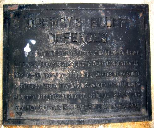 |
#56 Drewrys Bluff Defences Here, on the second line of the Drewrys Bluff defences, Confederate troops were concentrated May 12-15, 1864, to take the offensive against a Federal force that had advanced from Bermuda Hundred under command of General B.F. Butler and had cut the RichmondPetersburg railroad. |
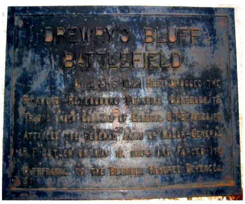 |
#57 Drewrys Bluff Battlefield On a line that here crossed the RichmondPetersburg turnpike, Confederate troops under command of General G.T. Beauregard attacked the Federal army of Major-General B.F. Butler on May 16, 1864 and forced its withdrawal to the Bermuda Hundred defences. |
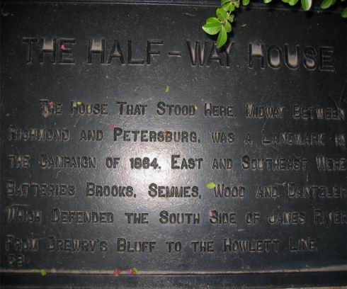 |
#58 The Half-Way House The house that stood here, midway between Richmond and Petersburg, was a landmark in the campaign of 1864. East and Southeast were Batteries Brooks, Semmes, Wood and Dantzler which defended the South side of James river from Drewrys Bluff to the Howlett Line. |
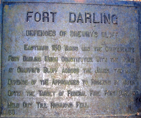 |
#59 Fort Darling Defences of
Drewry's
Bluff Eastward 150 yards was the Confederate Fort Darling which constituted, with the works at Chaffins Bluff across the James, the main defence of the approaches to Richmond by water. Often the target of Federal fire, Fort Darling held out till Richmond fell. |
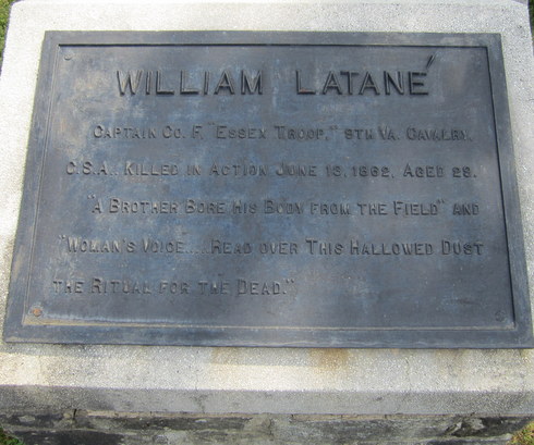 |
#60 William Latané
Captain Co. F, "Essex Troop," 9th Va. Cavalry, C.S.A., killed in action June 13, 1862, aged 29. "A brother bore his body from the field" and "woman's voice.....read over this hallowed dust the ritual for the dead." |